
Spring Virtual Field Trips
Sketching Together Online

Virtual field trips have become one of my favorite parts of teaching, ever since the Wild Wonder Nature Journaling Conference first moved online during the pandemic. I’ve always loved place-based learning—the connection to a landscape helps ground what we’re learning and makes it feel more relevant. I didn’t expect that connection to translate through a screen, but it does. While nothing replaces being outside together, it’s surprisingly fun (and much more accessible!) to explore and sketch a place over Zoom.
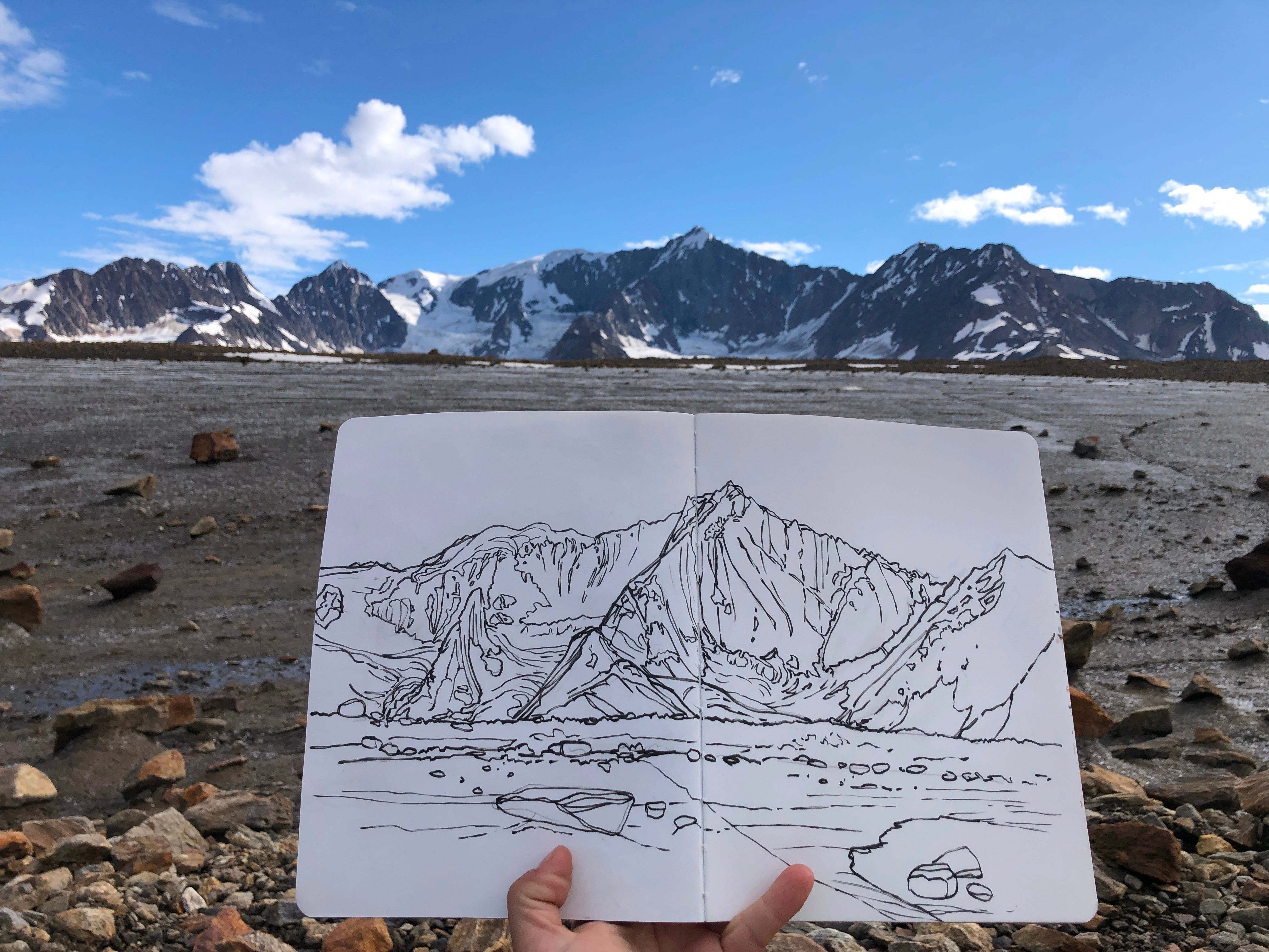
These virtual trips let us travel back in time—to enjoy summer in March—or visit remote places in Alaska that many people wouldn’t otherwise see. This spring, it’s been a joy to share some of my favorite locations with others through virtual field sketching classes.
Since my final class of the season is coming up this Friday (and yes, you can still join!), I thought I’d share a bit about how I put these sessions together, along with some sketching prompts for your own nature journal. And if you can’t make it live, no worries—I record all the classes so you can watch later at your own pace.


How It Works: A Peek Behind the Scenes
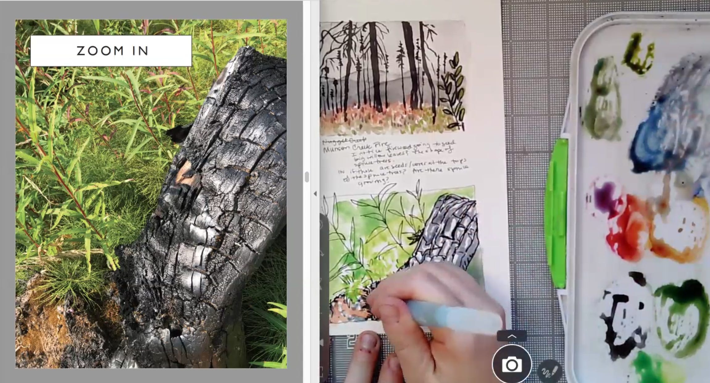
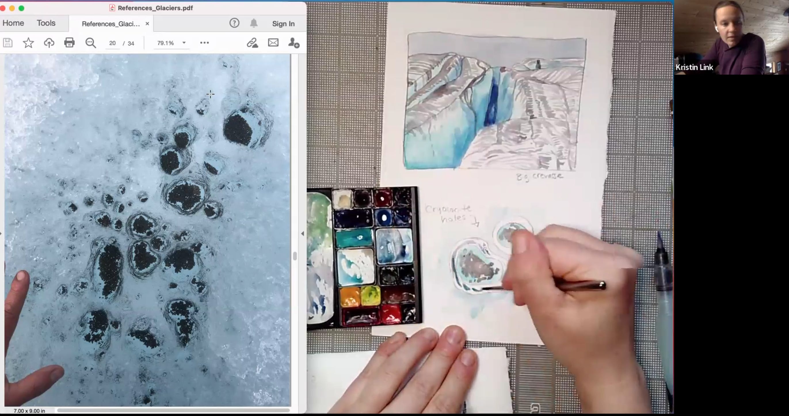
Here’s an example of my teaching setup: I create a split-screen presentation with a PDF of photos we can all work from together. I also use a document camera to share my sketchbook and demo techniques in real time. Each class has a Padlet where students can post their sketches, ask questions, and find reference materials and warm-up exercises to prepare.
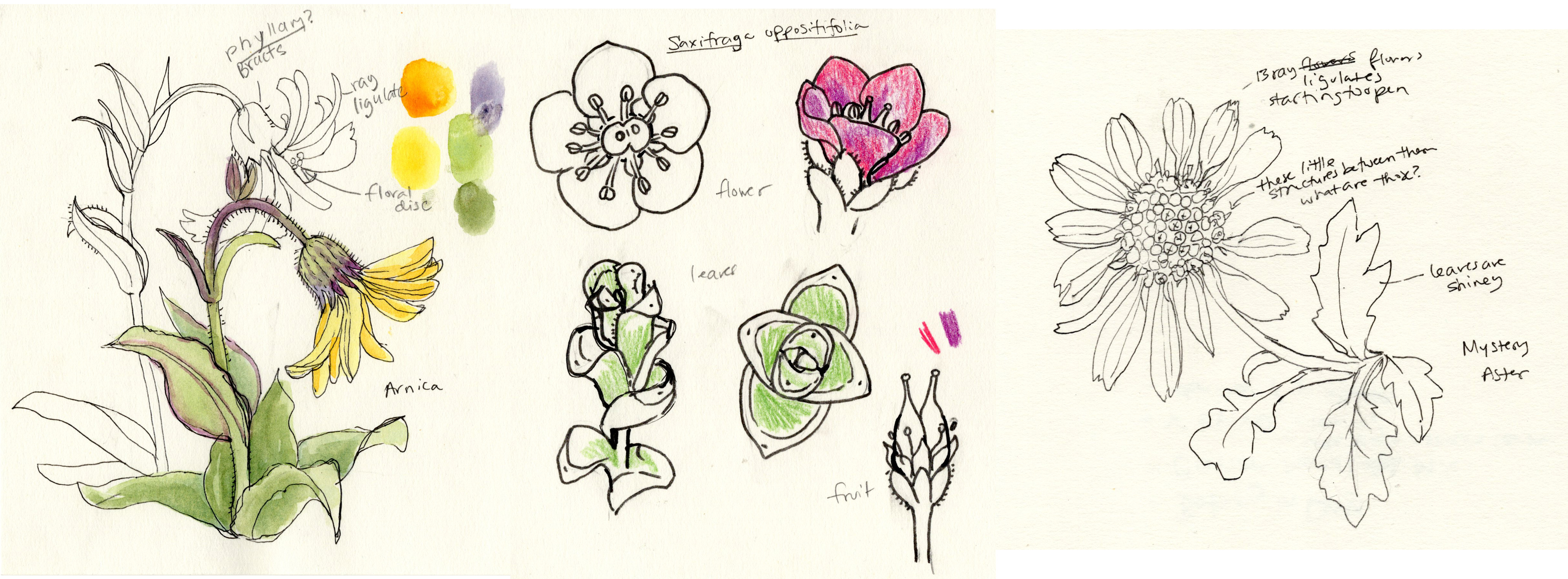
For my class on alpine plants, I made worksheets to help us study botanical vocabulary—especially vein patterns and leaf textures. These were also great drawing warm-ups, helping students develop a "visual vocabulary" or personal library of marks and textures.


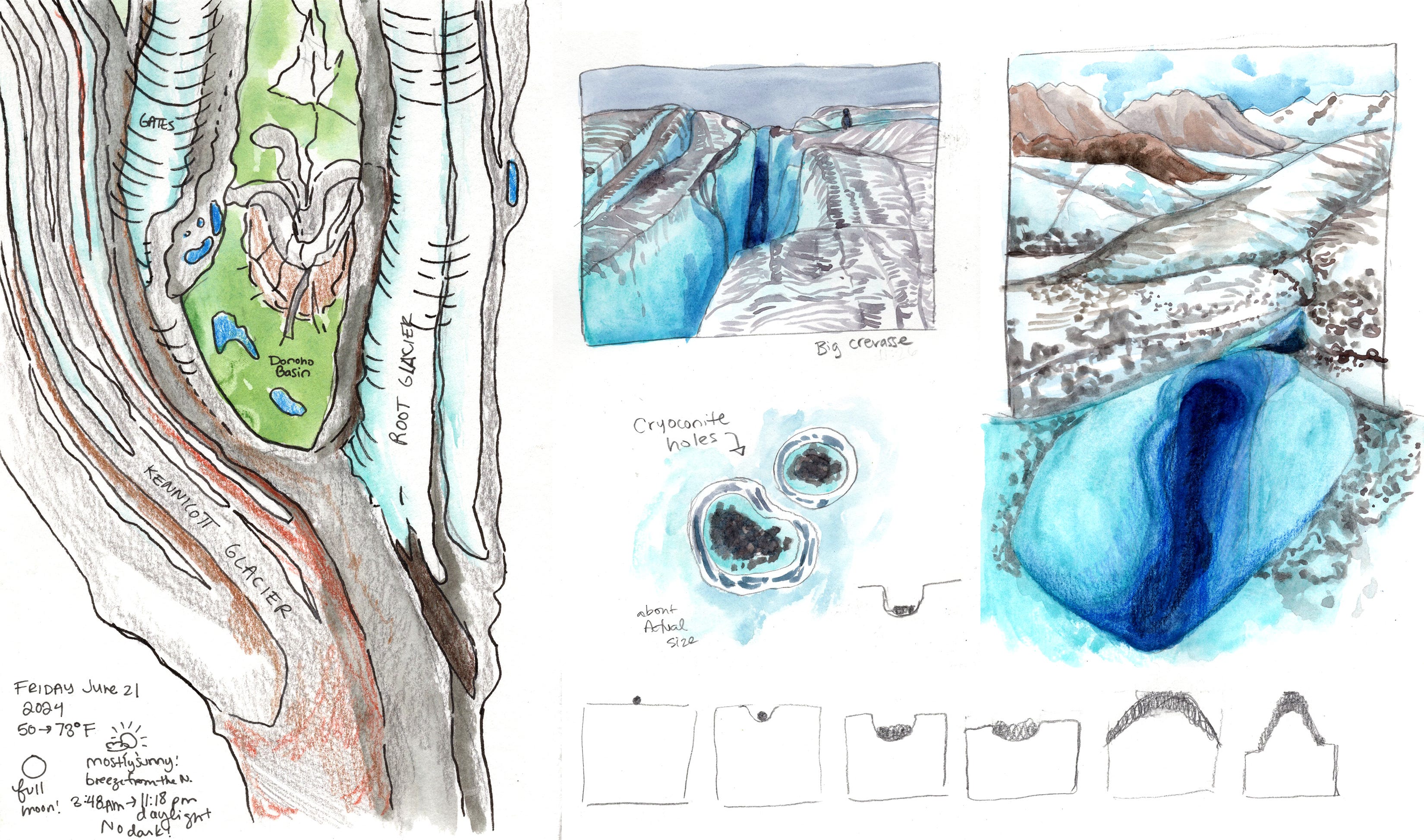
We usually begin each session with an orientation to place and weather, which helps it feel more like a real field trip. I like to log weather and location details in my own nature journal and often share maps from Gaia GPS or Google Earth. We even look up historical weather data using timeanddate.com.


Highlights from This Spring’s Virtual Adventures
In each class, we explore the landscape from a variety of perspectives—zooming in and out, and practicing different sketching techniques.
For our glacial features class, we started by drawing overview maps using satellite imagery (so helpful for understanding glaciers from above). Then we got "down on the ground" to study how glacial ice is affected by melt and insulation.
When we visited Nikolai Plateau to look at alpine plants, we focused more on drawing skills. We warmed up with blind contour drawings of various plants.
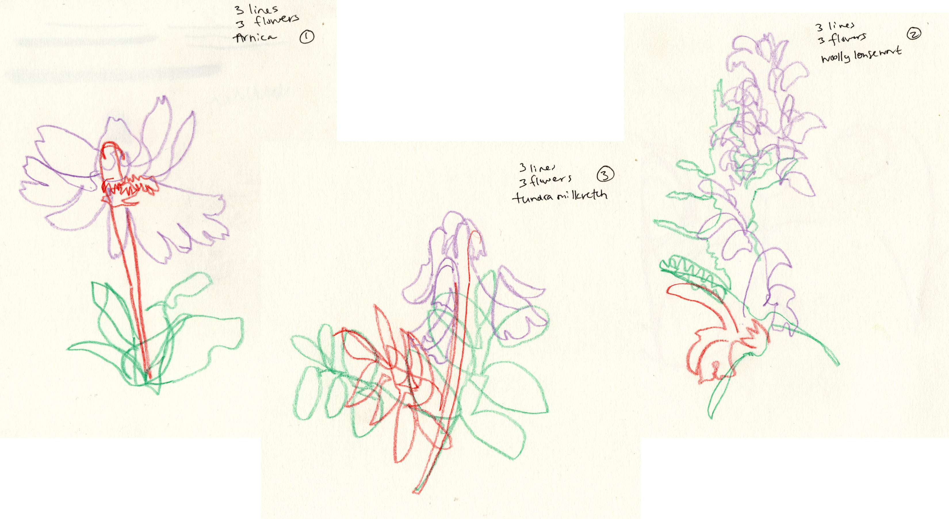
Then spent more time observing and diagramming a few species in detail. I even got tested on my aster family knowledge—and came up just a bit short! This is still a great learning experience since we don’t always have botany books with us in the field. We had a great time diagramming my favorite plant: Purple Mountain Saxifrage.
Part of this series supported a great cause—I’m proud to say we raised $350 for Inspiring Girls* Expeditions Alaska and their summer programs this year. Thank you to everyone who sketched along with me!
If you have any questions about virtual field trips—or if there’s a place you’d love to visit and sketch with me next year—I’d love to hear from you.